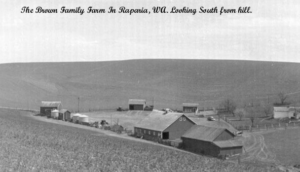
Brown Family Farm Page
Coming soon, other pictures of Farm click here
Brown Family Reunion at the Farm 2014
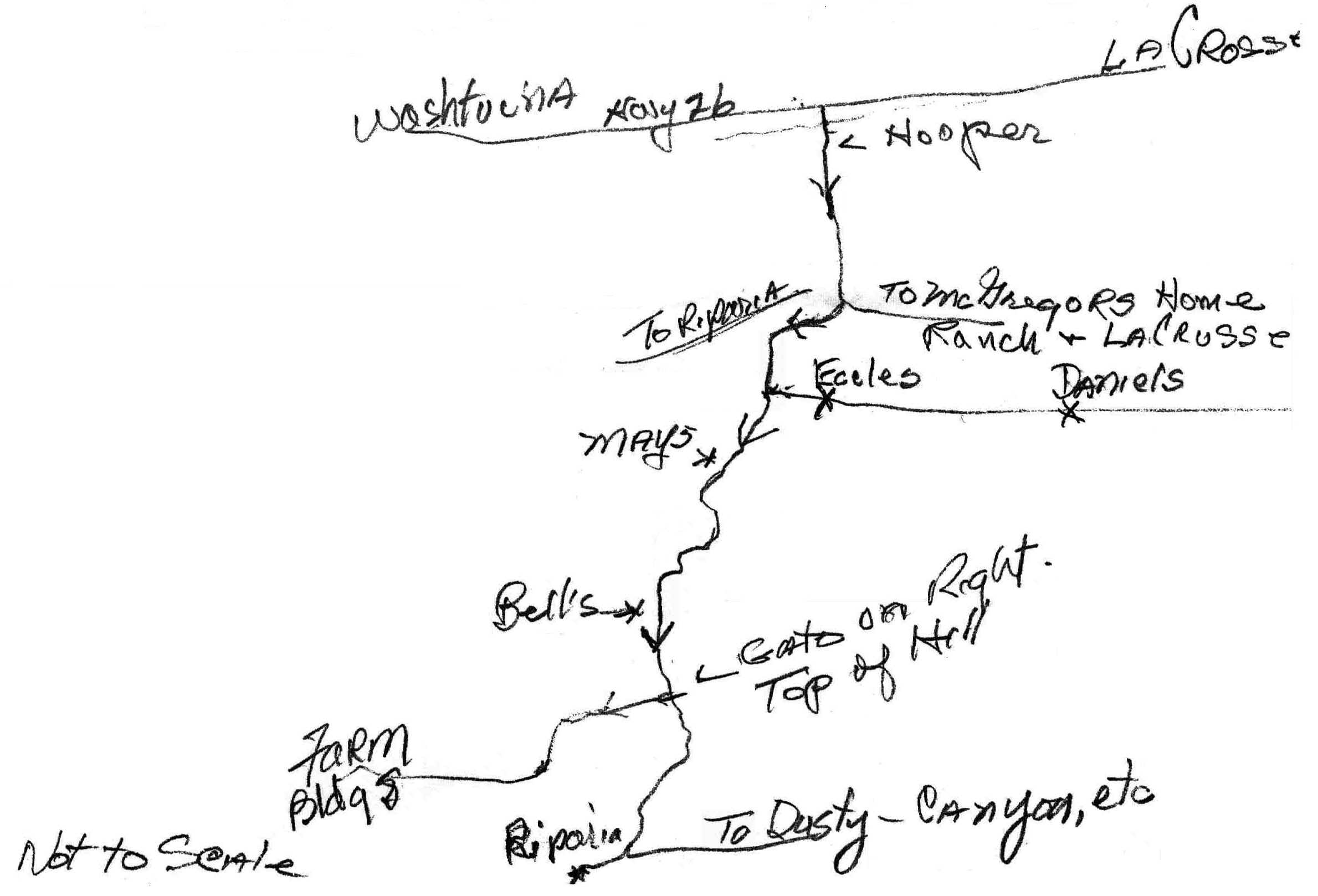
Instructions From Hooper, WA. to Brown farm (below)
(by Clyde Brown 11/2003)
Please note that mileage's quoted are from memory dating back to 1933 and are not to be taken literally. Otherwise they should be quite adequate.
From Highway 26, turn south at the junction to Hooper, WA. Cross the Palouse River, zig zag through the town and continue straight ahead (south) on an unmarked road to Raparia. You are driving through pastureland for a mile or so. About 1 1/2 to 2 miles you reach a "Y" in the road. Continue on the main road to the right. After a short distance you go through a gap and are now in farmland. After about 1 mile+ you start going uphill. You pass a farmhouse on the right (Mays), continue up, over and downhill on the other side. You soon reach the bottom, and pass the "Bell place" on the right. Again you start climbing and at the top of the hill you stop. Open the gate on the right side of the road, enter and close the gate. Drive along this ridge and down to another gate, pass through. turn right and the farmhouse and buildings were about 1/2 mile distance.
Warning: If you are in a automobile and the road has been disked you will probably hang up and be unable to get out.
Map below drawn by Clyde 11/14/2003