Washington Cascades
By Mike "Started 8/23/04
March 29, 2013
U.S. FOREST SERVICE NEWS RELEASE
Okanogan-Wenatchee National Forest
215 Melody Lane
Wenatchee, WA 98801
For immediate release: March 29, 2013 12p.m.
Contacts:
Naches Ranger District Public Info. Asst. Michelle King, (509) 653-1420
Naches Ranger District Front Country Trails Coordinator Kevin Hill, (509) 653-1436
Muddy Conditions Necessitate Seasonal Trail Closures
NACHES—Okanogan-Wenatchee National Forest managers plan to implement a seasonal closure on Naches Ranger District motorized trails from April 1 until June 15 to protect natural resources, minimize damage to trails and maintain quality trail systems. They have implemented similar temporary closures the past two years in wet spring months and will open trails earlier if drier conditions warrant it.
Naches Ranger District recreation managers have worked with motorized user groups to implement the closures in a manner that minimizes impacts to the public, while protecting natural resources. Both motorized and non-motorized user group members often volunteer to maintain trails and help educate the public on the adverse impacts of traveling on muddy trails. These impacts often include increased soil erosion and additional trail maintenance.
The Naches Ranger District seasonal restrictions apply to all trails with any type of motorized designation and includes all trail users, motorized or non-motorized.
Selected closure dates are flexible and based on weather information and existing trail conditions. Trails in different areas may open earlier or later than June 15. The Forest Service and volunteer partners will make every effort to keep trails cleared of logs and other forest debris so trail systems can be opened as soon as they dry out.
Approved volunteers will be permitted on certain trails prior to the opening date to assist with maintenance and help make trail opening determinations.
Naches Ranger District volunteers have proven to be an invaluable resource to the recreation program.
“Volunteers on the Naches Ranger District donated over 1,700 hours to motorized trail maintenance in just 2012 alone,” Naches Ranger District Recreation Planner Sue Ranger said. “The district looks forward to strengthening its relationships with its volunteers and utilizing their experience in monitoring trail conditions.” Naches District Ranger Irene Davidson said, “Law enforcement patrols, communication, and self-policing by trail users will increase the effectiveness of a seasonal motorized trail closures. Employees will continue to collaborate with local law enforcement to follow through with seasonal restrictions.” Information on the closure will be made available through signs on major roads, news releases, radio announcements and website notices. These same communication methods will be used to inform the public when trails open.
Naches Ranger District recreation managers will continue to assess the effectiveness of the spring motorized trail closure with regard to the intent of protecting trails and reducing annual maintenance needs.
February 15, 2013
U.S. FOREST SERVICE NEWS RELEASE
Okanogan-Wenatchee National Forest
215 Melody Lane
Wenatchee, WA 98801
For immediate release: February 15, 2013 – 2:45 PM
Contacts: Tim Foss – Cle Elum Ranger District Winter Recreation Manager - 509 852 1069
Nancy Jones – Cle Elum Ranger District Public Information Officer - 509 852 1011
Road Repairs to Disrupt Taneum Sno-Park
Cle Elum—Beginning Monday February 25, 2013, Forest Service Road 3300, Taneum, will be plowed from the Taneum Sno-Park to a point near the junction of Shadow Creek Road. The route will be closed to all traffic, including snowmobiles, until late afternoon on Friday March 1, 2013.
This closure will aid project engineers preparing for reconstruction of a segment of Taneum Road damaged by flood waters in May of 2011. Core samples will be collected by a drill rig which will be set in place on a very narrow section of the road; these samples will provide geologic data necessary for the implementation of repairs. Drilling will take place at a point where the road is flanked by a steep cut bank on the uphill side and Taneum Creek on the downhill side which makes a detour around the site impracticable.
Once the project is complete and equipment is removed from the area, and if conditions permit, snow will be moved back onto the route and groomed for winter recreation. If current weather conditions prevail, plowing may not be necessary. When weather and snow conditions permit, the Sno-Park will be moved further up the valley to near Icewater Creek Campground.
-End-
Nancy Jones
Visitor Services Information Assistant
Cle Elum Ranger District
Okanogan Wenatchee National Forest
najones@fs.fed.us
509 852 1011
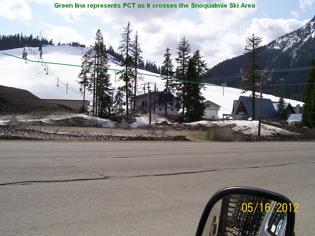
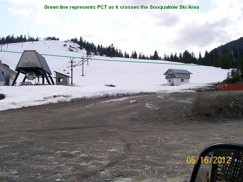
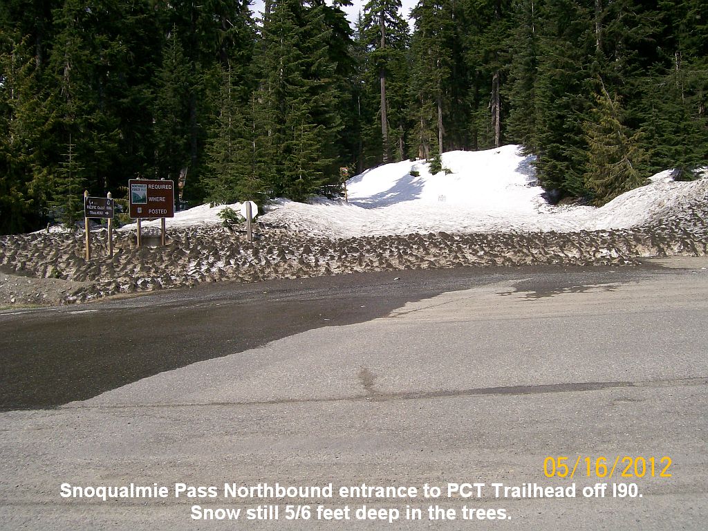
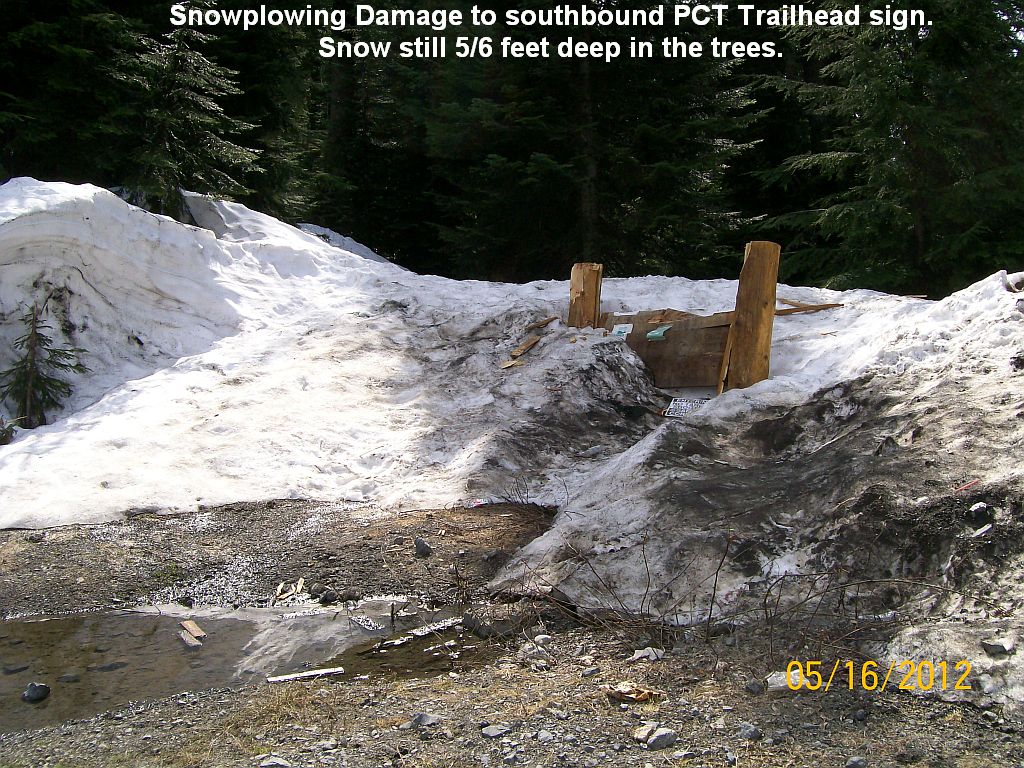
5/16/2012 PCT Snow Report from Snoqualmie Pass
No chance of using the PCT yet. About usual for the middle of May.
Ski area 1 Ski area 2 North bound PCT South bound PCT
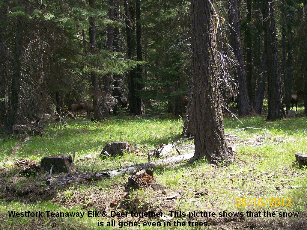
5/16/2012 Westfork Teanaway Report
We moved the camp trailer in Wednesday 5/16/2012. The road is in good shape and dry. Everything is green & pretty.
The elk & Deer are active in the Westfork. Here they are together.
Older reports from previous years to compare with are below...
Hunters Beware!
The following Copied from Forest Service website... 9/4/2011
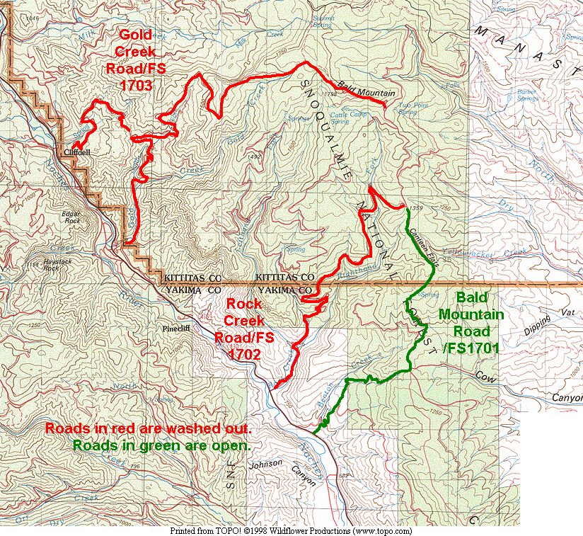
Cle Elum Ranger District Road Closures as of August 3 2011
The following Forest Service Roads are closed to motorized use due to flood damage. It is unlikely that these roads will open to public travel in 2011.
The following USFS roads are closed as of August 3 in the Cle Elum Ranger District (Chelan-Kittitas County line to the Manastash Ridge in Kittitas County):
3100-Manastash
CLOSED between the Sno-Park and Barber Springs, at Buck Meadows, and from the junction with 3120 to the end of the road at Quartz Mountain
Manastash
Sno-Park
Washout Pictures 10/9/2011
3120
Closed at a point between 3120 109 and 3100 near the Hoyt Mine Trail crossing
3330-Gnat Flat
CLOSED between 3300 and Gooseberry Flats
3350-Peoh Point
CLOSED due to flood damage 1.6 miles from Westside Road
3507-Crystal/Pole Patch
CLOSED due to numerous slumps in the road
9702-Red Top
Washed out at 1.5 miles
Road Closures in the Naches Ranger
District
Recent floods caused extensive damage to the following roads which have been closed to all traffic.
Naches Ranger District Road Conditions Road Name and Number Condition
Date
Tieton River Rd
No. 1207
Open from Road No. 1207-250 to non-motorized traffic which includes hikers, mountain bikes and horses. The Miriam Creek Bridge was stabilized enough to warrant use by these users.
6/7/2011
Little Rattlesnake Rd
No. 1501
Closed to all motorized traffic for 5.1 miles from the junction of forest road No. 1500/1501 (T15, R15, Sec 10) to the junction of forest road No. 1501 and forest road No. 1503 (T15, R14, Sec 24)
7/28/2011
Dry Ridge Rd
No. 1601
Closed to all motorized traffic from milepost 0.3 (T15, R15, Sec 30) to the junction with 1601/233 (T16, R14, Sec 25)
7/28/2011
Clover Way Rd
No. 1605
Closed to all motorized traffic for 3 miles from the junction of forest road No. 1600/1605 (T16, R14, Sec 16) to the junction of forest road No. 1605-244 (T15, R14, Sec 17)
7/28/2011
Rock Creek Rd
No. 1702
First 0.3 miles open to local residents only. Closed to public from junction with St. Rt. 410 (T16, R15, Sec 17) to the junction with forest road No. 1720 (T16, R15, Sec 4)
7/28/2011
Gold Creek Road
No. 1703
Closed to all motorized traffic for 5.9 miles from State Route 410 (T17, R14, Sec 36) to the end of forest road No. 1703 (T17, R14, Sec 24 junction with Road No. 1705)
7/28/2011
Milk Creek Road
No. 1708
Closed to all motorized traffic for 6.7 miles from the junction of Road No. 1708 and State Route 410 (T17, R14, Sec 9) to the junction with forest road 1708-590 (T17, R15, Sec 6)
7/28/2011
Bumping River Road No. 1800
Closed to all traffic beginning at its junction with Deep Creek Road No. 1808 (T16N R12E NE 1/4 Sec. 34) and ending 1/4 mile west of DeepCreek (T16N R12E SW 1/4 Sec. 34) and 300 feet on either side of the road from the centerline. Closed due to heavy construction on a new bridge. Will open late fall once bridge construction is complete. 07/05/2011
Deep Creek Road No. 1808 Closed to all traffic beginning at the the point of intersection with Copper Creek near Mt. Aix trailhead (T15N R12E SE 1/4 Sec.3) and ending 1/4 mile west of Deep Creek (T15N R12 E NE 1/4 Sec. 16) and 300 feet on either side of the road from the centerline. Deep Creek Road is not scheduled to open this year due to more flood damage further up the road which is current not accessible until the bridge is completed. 07/05/2011
PCT Trail report
8/30/2011These guys did a 10 day hike from Stevens to Snoqualmie in late August.
Hey Mike,
Yeah I can give you that report. I'm sending this also to my buddy Kevin Radach who was our chief navigator for the trip so that he can chime in or correct me if need be. So please do Kevin, add or subtract for accuracy and let Mike know.
See Kevin's report below Zach's report...I can give you a full report from Steven's to Snoqaulmie if you'd like, with trail conditions/blow downs and stream levels/route changes and all that just let me know.
But as for the portion of trail you selected:
Snoqualmie to Huckleberry Saddle - A couple pretty major blow downs for first 5 miles (could be cleared now) ok for boots not sure though for hooves. Heavy day hiker traffic all the way to the catwalk. After Kendalls Catwalk we did cross some snow patches, southern and northern sides of Alaska Mtn, (could be gone now) crossed just fine without crampons just trekking poles. Snow free pretty much from Joe Lk through to Huckleberry Saddle, good trail.
Huckleberrry Saddle along Chikamin Ridge- Came through in the morning so temperature was glorious. A few snow crossings here that had potentials for bad falls but got through with patience (again could be all melted now).
Chikamin Ridge to Park Lks- Just fine, stock camping looked good here at Park Lks. Note if planing on going down to Glacier Lk from here allot yourself a couple hours to get down and another couple to get back out. Trail is wet steep and nonexistent in some places. But the Lake was gorgeous and we saw a couple mountain goats in this area and I highly recommend watching the stars come out from the Stone Kingdom over looking Spectacle Lk. if camping near here.
Parks Lks through Lemah Valley to Escondia Ridge- If coming from the south the hiker trail off the PCT down to Spectacle Lk will be easily spotted and marked but if coming from the North do note that old trail up to the lake was destroyed by fire and older maps and GPS may show it's still there, continue up the ridge on PCT to where the new trail down to lake is. Lemah Valley had some blow downs but we saw horse tracks all the way up to Spectacle so they must have been getting through also the burn killed some shade but gave you good views instead. South side of Escondia Ridge had some major blow downs also. Camping on top of Escondia Ridge is prohibited as its a fragile area so heads up in case you hiked 17 miles and were expecting to camp there , but well used sites were on the south side. Also fill water here as the North side of Escondia ridge is long and has heavily brushed narrow switch backs all the way down to the Waptus River bridged crossing.
Waptus Lk to Cathedral Rock- Trail along Waptus Lk was solid with some minor wet boot stream crossings. I believe we did take the section of trail labeled "new route" after we camped at Peggy's Pond (Kevin back me up on this) the 3 mile down to Deep Lake from Cathedral Rock. So it's there and a long climb if coming from the south.
Also for stock do take the resupply route around the east bank of Hyus Lake to or from Deception Pass in either direction because the trail down the east side of Cathedral Rock is steep very narrow in places with high brush and the second stream crossing before Deception pass (from south) is unfit for livestock and can be a little unnerving even for hikers so heads up. We crossed a little higher up here then where the trail actually crosses in a shallower- slower part. Still had water up past our knees though.
So here's the report as best I can remember for this marked section. The two biggest things were that the bugs were awful this year, we got mauled at every stop but we're tough and the blow downs. But we heard from a ranger that they were sending in Trail Association crews into the bad spots like south Escondia Ridge soon and we saw one small crew 1 day out from Stevens clearing so it might be better now then when we passed through.
But I had a blast and so did the other guys as this part of the trail is a butt-kicker but the views make it absolutely worth it. Some of the prettiest country I've seen.
By the way the maps on your site are really good, I'll keep the website in mind for our next trek.
Hope this helps Mike, Zach
Zach, your report looks good. I'll restate that significant snow remained at Ridge and Gravel lakes at 7 miles north or Snoqualmie, however from what we saw the campsites are melted out. The north side of Alaska Mt had snow but may be gone now. From Joe Lake to Huckleberry Saddle the trail is in good condition. The Chikamin traverse had three snow crossings all less then 30 ft, however none had safe run out. An ice axe would have been nice but good steps exist and we crossed in the morning with no issues and just boots and trekking poles. The trail is very narrow and exposed in places. From Chikamin pass to Spectacle lake the trail is fine (A new side trail to Spectacle lake has be put in further south on the PCT (if coming from the north). Our maps as of 2006 did not show the new trail because I believe the wild fire was in 2008 and the trail is now gone.) Good camps for both stock and hikers in Park Lakes basin. From Spectacle Lake to Escondido ridge the trail is in good condition except for some large blowdowns and countless small blow downs. The Lemah creek bridge is gone. A short shallow ford is needed. I think that is the only thing Zach's report is missing. Many blow downs on the south side. Camping on Escondido ridge is allowed on the south side. Two lakes are off trail and provide water. The northeast side is better but no camping is allowed and no real sites exist to my knowledge. The north side of the ridge is brushy but only a few small blow downs. Like Zach stated a WTA crew was supposed to work there the first week of September. Waptus river valley is fine and the ascent to Deep lake up the Spinola creek valley has only a few minor blow downs. Oh and Zach the trail is not "new" but did not show up on our older maps. The section from Waptus Lake to Deception pass about 11-13 miles does not show up on the topo maps for some reason. More updated maps should show the trail.The Deep Lake outlet requires a ford but is very slow and only about 6 inches deep.From Cathedral Pass to Deception Pass the trail is unsuitable for stock. The detour via the Hyas Lake valley is needed. However, hikers can pass just fine. The first and third of the stream crossings are simple but the middle crossing is more challenging. We crossed in a wide pool just of the end of the last switchback corner about 20 yards above where the trail ends to cross a narrow gully. The water was knee depth and fast but we crossed around 1 in the afternoon. From Deception Pass to Stevens Pass the trail is clear except for countless blow downs. Pieper Pass is holding significant snow on the north side, but it is passable. We did see a trail crew between Hope and Mig Lakes. Snow and minor blow downs on the trail to Lake Josephine are easy to navigate. From the lake to Stevens is snow free and mostly clear with a few brushy spots.
Zach, sorry if that is more info than what you needed from me. I had fun writing it though! Hope it helps.
-Kevin
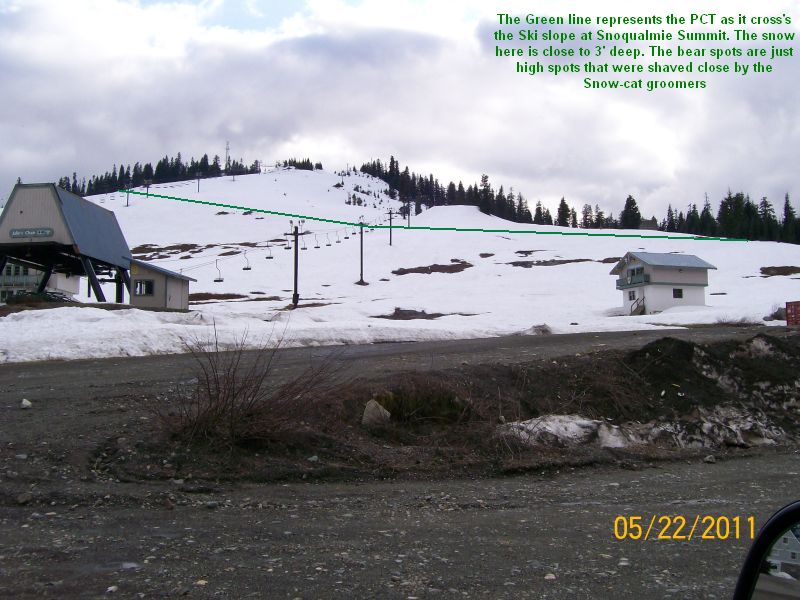
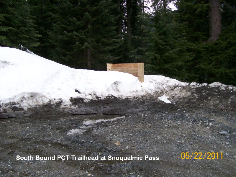
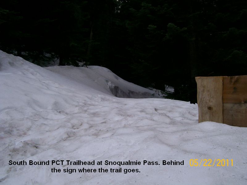
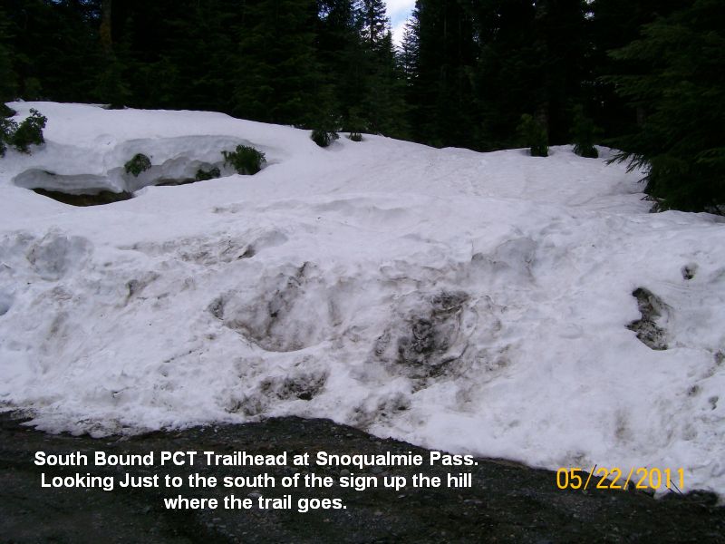
PCT Trail report 5/22/2011
Mike & Patti stopped at Snoqualmie summit so we could make a report on the PCT Trailhead.
Lots of snow left this year. Click on pictures to see full size
Shot of Ski area Shot of SB Trailhead Shot of SB Trailhead Shot of SB Trailhead
There are some as of 7/30/9
http://www.fs.fed.us/r6/wenatchee/conditions/index.shtml
Lemah Meadows closes Crest Trail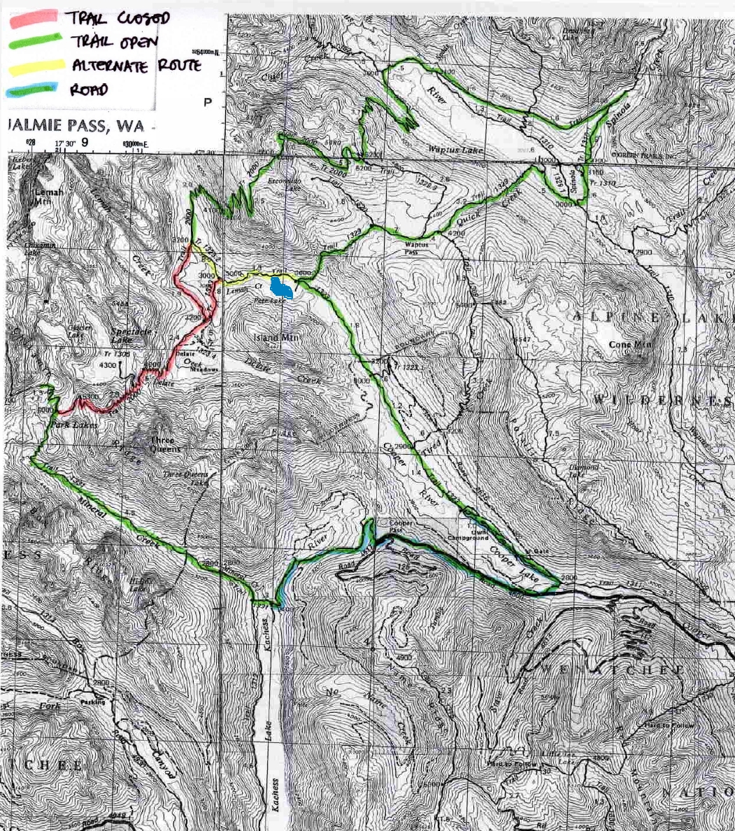
Snoqualmie Summit / PCT Trail Conditions 4/23/10
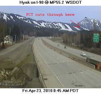
Deep snow remains over PCT in the central Cascades 4/23/10
Redmond Ridge East TRAIL CLOSURES 6/6/2010
Hello All,
Here is an attachment about the Redmond Ridge East TRAIL CLOSURES
due to
construction of a road that will effect all trail users especially
equestrians. Please pass this
information on to other equestrians and post it on local equestrian
websites.
Also attached is information about trail closures in the Redmond Watershed
and elsewhere in the vicinity of the Puget Sound Energy Novelty-Cottage
Brook 115 volt transmission
line work between Avondale Rd. and Novelty Hill, that you may not have heard
about. Please pass on the information about these closures to equestrians.
If there are any updates or other concerns about these closures, that PSE
and Thom Gebhard from Murray Franklin Homes, they will contact me and I will
forward it to all of you.
Thank you very much,
Judy Westall
Novelty Hill - Cottage Brook Construction Notice FINAL
Better read this... New for 2009
Weed-free Feed Required in Northwest ForestsNew for 2011
Beware.. Use of DNR lands or State Parks will need a Discover Pass
read about it here... Discover Pass
Mike & Patti were laid up most of 2008. Patti had carpal tunnel surgery done on both wrists and Mike's Dad died mid summer.
So we did not get out any the summer of 2008. We are looking forward to updating the trail reports early spring 2009.
The animals are fat & sassey and will take some time to get in shape. <grin>
Pictures of Chinook Pass Arch showing spring snow depths over the years. This can give you an idea of why the trails open so late in the year.
Arch PicturesI get a feel for when the Cascades will be clear enough for trail work by looking at these pictures.
Chinook Pass-Cayuse Pass Snow Removal Update & Pictures
Mike & Patti stopped by the Snoqualmie Pass Trailhead for the Pacific Crest Trail.
We found about 6’ of snow on the ground both Northbound and Southbound.
The Southbound parking area is snowplowed right up to the sign where the trail takes of into the woods.
The road into the northbound parking lot has not been plowed.
Below are a couple of pictures at the southbound trailhead.
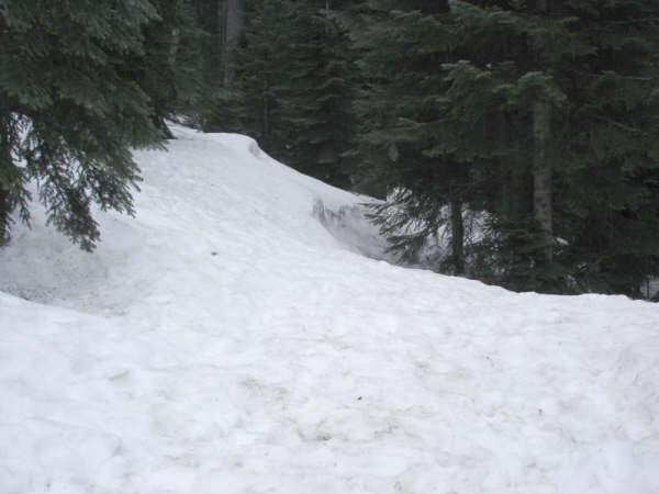
Picture taken at southbound trailhead spring 4/14/07
Notice top of sign & compare to next picture
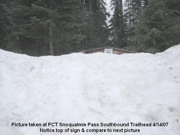
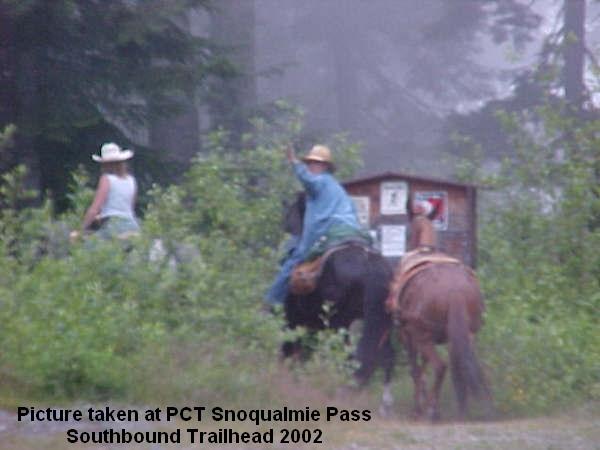
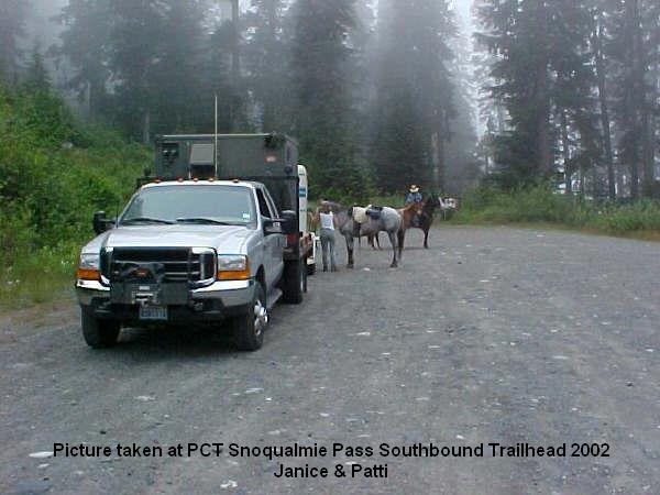
For comparison, taken summer 2002 (Notice top of sign)
This picture taken from the trailhead sign looking south down PCT.
4/14/2007
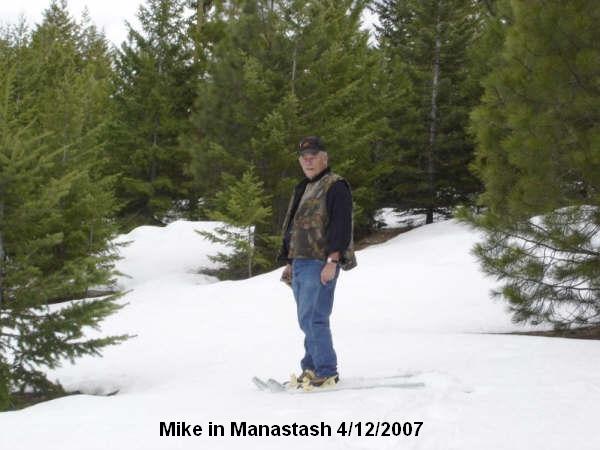
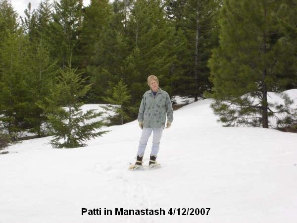
Mike and Patti snowshoed up the North side of Manastash Ridge just North of
Barbra Springs checking snow conditions.
Still to deep for horses...
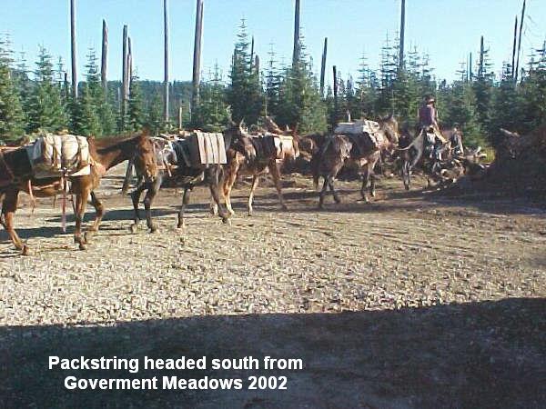
Goverment Meadows PCT Trailhead 9/7/02